The World “is” Flat
 Oh sure those nerdy science types will give you explanations and “supposed” evidence that the world isn’t round. Blah-blah-blah.
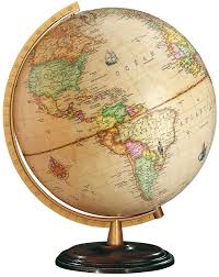
But let’s face it … we are humans and the way our brains work it’s simply easier to see things in 2 dimensions. So unless you have a new fangled holographic imaging systems even a sphere shaped globe appears to you as 2 dimensions.
Oh sure those nerdy data visualization types will tell you that your eyes interpret shades of light and dark as distance … but let’s face it … that just makes the situation worse for us. People fool us in paintings with shades of light/dark into thinking something is 3 dimensional when in fact it isn’t.
Solid Logical Argument for the World being Flat
Don’t trust them. I propose that in our weakened human state of brain power it’s easier if we just get our maps on a piece of paper that is flat rather than some hologram. Hard to argue with solid logic right? If it’s easier … then it must be true.
Alright! You win. The world isn’t flat. But trust me it would be a whole lot easier if it was so when you get to the end of this post you are going to wish you had simply agreed with me.
Round?
Here is the problem not only is the world not flat, it isn’t round either. Did I mention that measuring it continually evolves as we get more and precise instrumentation? Meaning that as we gain technical proficiency are perception of the shape of the globe actually changes.
It gets better. That shape you think continents have … they change.
But wait there’s more … there is this thing called Continental Drift which means those great big things that you think are locked down, are actually moving.
Where are you?
All this poses a serious issue for us … because a lot of how we define ourselves has to do with “where we are.” Tell me where you are so that I can come and verify you really exist.
Seriously! Go for it. Where are you?
You see my point yet? How are you even going to tell me where you are in a world that is ever changing it’s shape and position?
Enter Latitude and Longitude
Oh look there is smarty pants in Illinois pulling out his phone right now and he says he is at X Latitude and Y Longitude. Super duper. That helps me a lot if you can tell me what Datum was used to calculate the Latitude and Longitude you just gave me.
Because if you are just telling me a Lat/Long value it doesn’t really help me reproduce where you are to verify that you exist. I’ve got to be using the same system.
Never heard the word “datum” before? Yeah me neither until I recently ventured into this whole geo analytics stuff. But don’t worry you can find all you ever wanted to know by clicking here to read this great resource. It only took me 3-4 reads before I could pronounce most of the words so feel free to give it a shot.
Precision Matters
Once you are comfortable telling me your Latitude and Longitude and can tell me if that was determined by the NAD27, NAD83 or WGS84 Datum I can get close to your location. Close to proving you exist may or may not be good enough though.
Ok let’s be real … none of you need me to come and prove you exist. But let me ask you this “Do you care if you can find that address you are trying to get to?” Because Latitude and Longitude can actually come in 2 flavors: Centroid and Polygon.
No. For real. It’s not as simple as you think. Take for instance a location that is part of some giant outdoor shopping mall, or a giant apartment complex. As you read about Centroid and Polygon calculations you will discover that some times the lat/long of an address is calculated as a guesstimate based on the entire range of addresses. (For your continued reading pleasure as you dive into Geo Analytics be sure to favorite this awesome GIS Dictionary site thanks to ESRI.)
Get the “point”
You get the pun there? It would be funnier if you could see my facial expressions as I said “Get the point” but hey this is a written blog and I haven’t started my Dork Casts video channel yet.
Regardless of flat/round/sphere/ellipsoid … there are a lot, and I mean a lot, of publicly available data sets out there and frankly I want you to tap into as many as you can. In the embedded video you will see that I find one such site and say to myself “Gee I’d like to visualize this data.” It’s a “Shapefile” that contains the polygons (shapes) as well as the data that I need for coloring.
Here is where the Qlik GeoAnalytics applications comes in really handy … I can load the shapefile in it’s ZIP format and ingest the data and the shapes and get right to visualizing the data. Oh yeah, I actually walk you through all that Datum stuff in the video as well so perhaps it will help you make sense of it.
Proving you exist by your location is kind of a joke. But visualizing the world around you is serious business. If you are interested in population health like me then you likely want to tap into all sorts of Social Determinants of Health. But even if you are using your analytics/visualization skills in a totally different field … the point is there is geo data out there … just waiting for you to explore.

